
- Start >
- Groundwater >
- Waterlevel of upper layer >
- Bayern >
- ST. 2078 ARMCO KO 41 >
- Chart of total period

Chart of total period ST. 2078 ARMCO KO 41
Groundwater levels of the total period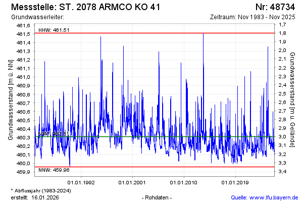
Groundwater level [m above sealevel]: 460.22
Distance to surface [m]: 3.09
Last value from 08.04.2026 09:54
Ground level [m above sealevel]: 463.31
| Date | Groundwater level [m above sealevel] |
|---|---|
| 08.04.2026 | 460.22 |
| 07.04.2026 | 460.23 |
| 06.04.2026 | 460.23 |
| 05.04.2026 | 460.24 |
| 04.04.2026 | 460.24 |
| 03.04.2026 | 460.25 |
| 02.04.2026 | 460.26 |
| 01.04.2026 | 460.27 |
© Bayerisches Landesamt für Umwelt 2026