
Chart of total period SR/GW EBE FO 02
note
Messstelle wird nicht mehr beobachtet.
Groundwater level [m above sealevel]: 523,22
Distance to surface [m]: 19,97
Last value from 15.04.2026 11:07
Ground level [m above sealevel]: 543.19
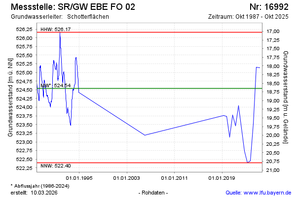
| Date | Groundwater level [m above sealevel] |
|---|---|
| 14.10.2025 | 524.14 |
| 23.04.2025 | 525.14 |
| 09.10.2024 | 525.15 |
| 17.04.2024 | 523.52 |
| 18.10.2023 | 522.45 |
| 18.04.2023 | 522.40 |
| 19.10.2022 | 522.74 |
| 12.04.2022 | 523.39 |