
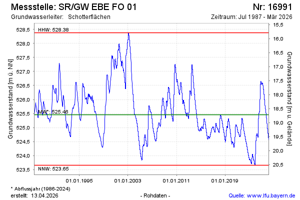
Chart of total period SR/GW EBE FO 01
Groundwater level [m above sealevel]: 524,19
Distance to surface [m]: 19,98
Last value from 16.06.2026 08:44
Ground level [m above sealevel]: 544.17
| Date | Groundwater level [m above sealevel] |
|---|---|
| 16.06.2026 | 524.19 |
| 15.06.2026 | 524.20 |
| 14.06.2026 | 524.20 |
| 13.06.2026 | 524.21 |
| 12.06.2026 | 524.21 |
| 11.06.2026 | 524.22 |
| 10.06.2026 | 524.22 |
| 09.06.2026 | 524.23 |