
- Start >
- Groundwater >
- Waterlevel of upper layer >
- Bayern >
- SPINNEREI KO 43 >
- Chart of total period

Chart of total period SPINNEREI KO 43
Groundwater levels of the total period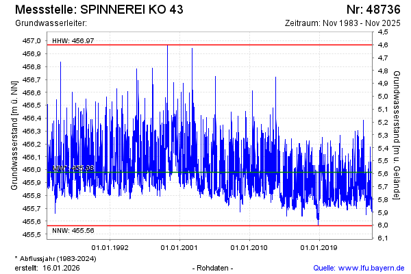
Groundwater level [m above sealevel]: 455.94
Distance to surface [m]: 5.63
Last value from 08.04.2026 07:58
Ground level [m above sealevel]: 461.57
| Date | Groundwater level [m above sealevel] |
|---|---|
| 08.04.2026 | 455.94 |
| 07.04.2026 | 455.95 |
| 06.04.2026 | 455.92 |
| 05.04.2026 | 455.80 |
| 04.04.2026 | 455.77 |
| 03.04.2026 | 455.76 |
| 02.04.2026 | 455.76 |
| 01.04.2026 | 455.77 |
© Bayerisches Landesamt für Umwelt 2026