
- Start >
- Groundwater >
- Waterlevel of upper layer >
- Bayern >
- Simbach GWM 113 >
- Chart of total period

Chart of total period Simbach GWM 113
Groundwater levels of the total period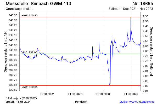
Groundwater level [m above sealevel]: 340.31
Distance to surface [m]: 2.33
Last value from 25.02.2025 10:00
Ground level [m above sealevel]: 342.64
| Date | Groundwater level [m above sealevel] |
|---|---|
| 25.02.2025 | 340.31 |
| 24.02.2025 | 340.31 |
| 23.02.2025 | 340.30 |
| 22.02.2025 | 340.31 |
| 21.02.2025 | 340.31 |
| 20.02.2025 | 340.31 |
| 19.02.2025 | 340.31 |
| 18.02.2025 | 340.31 |
© Bayerisches Landesamt für Umwelt 2026