
- Start >
- Groundwater >
- Waterlevel of upper layer >
- Bayern >
- SIEBENSEE 95 >
- Chart of total period

Chart of total period SIEBENSEE 95
Groundwater levels of the total period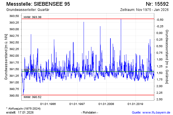
Groundwater level [m above sealevel]: 391.49
Distance to surface [m]: 1.37
Last value from 12.03.2026 10:00
Ground level [m above sealevel]: 392.86
| Date | Groundwater level [m above sealevel] |
|---|---|
| 12.03.2026 | 391.49 |
| 11.03.2026 | 391.51 |
| 10.03.2026 | 391.52 |
| 09.03.2026 | 391.54 |
| 08.03.2026 | 391.55 |
| 07.03.2026 | 391.57 |
| 06.03.2026 | 391.59 |
| 05.03.2026 | 391.61 |
© Bayerisches Landesamt für Umwelt 2026