
- Start >
- Groundwater >
- Waterlevel of upper layer >
- Bayern >
- Seidlthal W 5 >
- Chart of total period

Chart of total period Seidlthal W 5
Groundwater levels of the total period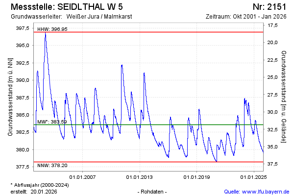
Groundwater level [m above sealevel]: 379.47
Distance to surface [m]: 35.95
Last value from 08.01.2026 10:51
Ground level [m above sealevel]: 415.42
| Date | Groundwater level [m above sealevel] |
|---|---|
| 08.01.2026 | 379.47 |
| 07.01.2026 | 379.48 |
| 06.01.2026 | 379.48 |
| 05.01.2026 | 379.49 |
| 04.01.2026 | 379.50 |
| 03.01.2026 | 379.52 |
| 02.01.2026 | 379.54 |
| 01.01.2026 | 379.56 |
© Bayerisches Landesamt für Umwelt 2026