
- Start >
- Groundwater >
- Waterlevel of upper layer >
- Bayern >
- Schweitenkirchen tief >
- Chart of total period

Chart of total period Schweitenkirchen tief
Groundwater levels of the total period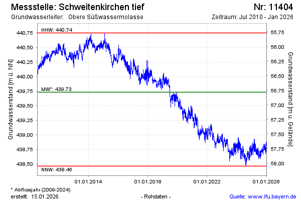
Groundwater level [m above sealevel]: 438.68
Distance to surface [m]: 57.83
Last value from 06.05.2024 10:00
Ground level [m above sealevel]: 496.51
| Date | Groundwater level [m above sealevel] |
|---|---|
| 06.05.2024 | 438.69 |
| 05.05.2024 | 438.70 |
| 04.05.2024 | 438.72 |
| 03.05.2024 | 438.74 |
| 02.05.2024 | 438.76 |
| 01.05.2024 | 438.73 |
| 30.04.2024 | 438.70 |
| 29.04.2024 | 438.68 |
© Bayerisches Landesamt für Umwelt 2024