Year chart of precipitation SCHWAIG 6A
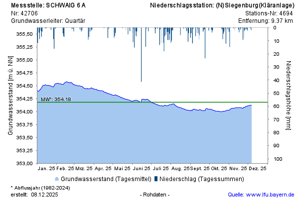
Groundwater level [m above sealevel]: 353,89
Distance to surface [m]: 3,05
Last value from 23.07.2026 10:00
Ground level [m above sealevel]: 356.94

Groundwater level [m above sealevel]: 353,89
Distance to surface [m]: 3,05
Last value from 23.07.2026 10:00
Ground level [m above sealevel]: 356.94