
- Start >
- Groundwater >
- Waterlevel of upper layer >
- Bayern >
- SCHWABMUENCHEN 91 >
- Chart of total period

Chart of total period SCHWABMUENCHEN 91
Groundwater levels of the total period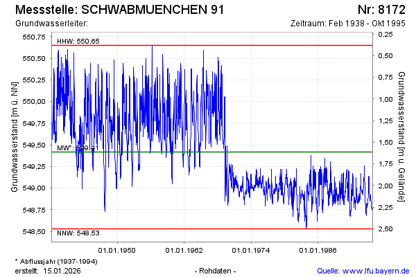
Groundwater level [m above sealevel]: 548.77
Distance to surface [m]: 2.26
Last value from 30.10.1995 12:00
Ground level [m above sealevel]: 551.03
| Date | Groundwater level [m above sealevel] |
|---|---|
| 23.10.1995 | 548.76 |
| 16.10.1995 | 548.76 |
| 09.10.1995 | 548.77 |
| 02.10.1995 | 548.77 |
| 25.09.1995 | 548.76 |
| 18.09.1995 | 548.77 |
| 11.09.1995 | 548.76 |
| 04.09.1995 | 548.75 |
© Bayerisches Landesamt für Umwelt 2026