
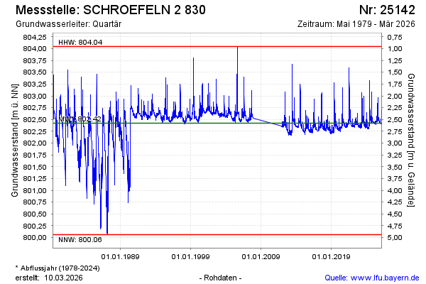
Chart of total period SCHROEFELN 2 830
Groundwater level [m above sealevel]: 802,49
Distance to surface [m]: 2,51
Last value from 22.07.2026 16:00
Ground level [m above sealevel]: 805.00
| Date | Groundwater level [m above sealevel] |
|---|---|
| 22.07.2026 | 802.49 |
| 21.07.2026 | 802.49 |
| 20.07.2026 | 802.50 |
| 19.07.2026 | 802.50 |
| 18.07.2026 | 802.50 |
| 17.07.2026 | 802.49 |
| 16.07.2026 | 802.50 |
| 15.07.2026 | 802.50 |