
- Start >
- Groundwater >
- Waterlevel of upper layer >
- Bayern >
- SCHRETZHEIM 966 >
- Chart of total period

Chart of total period SCHRETZHEIM 966
Groundwater levels of the total period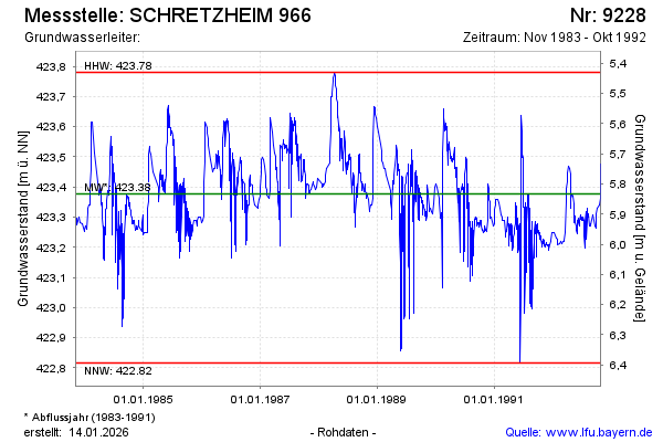
Groundwater level [m above sealevel]: 423.47
Distance to surface [m]: 5.74
Last value from 31.10.1992 23:59
Ground level [m above sealevel]: 429.21
| Date | Groundwater level [m above sealevel] |
|---|---|
| 31.10.1992 | 423.47 |
| 28.10.1992 | 423.41 |
| 26.10.1992 | 423.36 |
| 21.10.1992 | 423.34 |
| 08.10.1992 | 423.33 |
| 04.10.1992 | 423.31 |
| 01.10.1992 | 423.27 |
| 29.09.1992 | 423.26 |
© Bayerisches Landesamt für Umwelt 2026