
- Start >
- Groundwater >
- Waterlevel of upper layer >
- Bayern >
- SCHNEEBERG 179 >
- Year chart of precipitation

Year chart of precipitation SCHNEEBERG 179
Groundwater levels of the last 12 months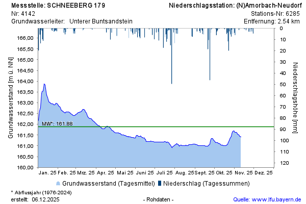
note
Datenfernübertragung ist ausgefallen. Monatliche Auslesung der Daten.
Groundwater level [m above sealevel]: 161,26
Distance to surface [m]: 26,19
Last value from 08.12.2025 14:00
Ground level [m above sealevel]: 187.45
© Bayerisches Landesamt für Umwelt 2026