
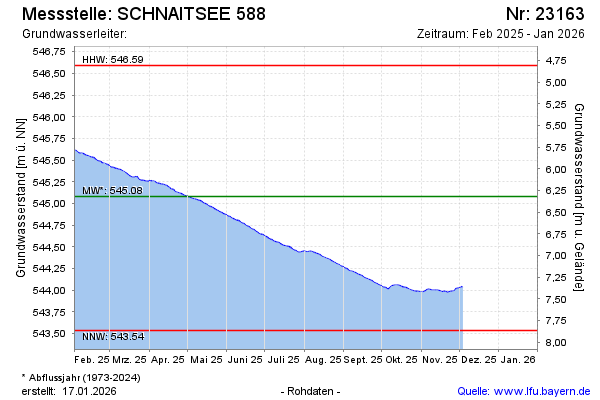
Current data SCHNAITSEE 588
Groundwater level [m above sealevel]: 543,45
Distance to surface [m]: 7,95
Last value from 13.07.2026 07:00
Ground level [m above sealevel]: 551.40
| Date | Groundwater level [m above sealevel] |
|---|---|
| 13.07.2026 | 543.46 |
| 12.07.2026 | 543.46 |
| 11.07.2026 | 543.47 |
| 10.07.2026 | 543.47 |
| 09.07.2026 | 543.48 |
| 08.07.2026 | 543.48 |
| 07.07.2026 | 543.49 |
| 06.07.2026 | 543.49 |