
- Start >
- Groundwater >
- Waterlevel of upper layer >
- Bayern >
- Schmausenbuck (K-11) >
- Chart of total period

Chart of total period Schmausenbuck (K-11)
Groundwater levels of the total period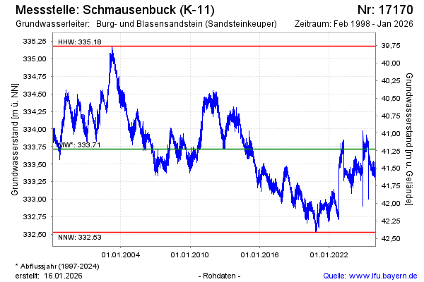
Groundwater level [m above sealevel]: 333.44
Distance to surface [m]: 41.50
Last value from 15.05.2024 10:00
Ground level [m above sealevel]: 374.94
| Date | Groundwater level [m above sealevel] |
|---|---|
| 15.05.2024 | 333.46 |
| 14.05.2024 | 333.46 |
| 13.05.2024 | 333.44 |
| 12.05.2024 | 333.42 |
| 11.05.2024 | 333.41 |
| 10.05.2024 | 333.40 |
| 09.05.2024 | 333.37 |
| 08.05.2024 | 333.34 |
© Bayerisches Landesamt für Umwelt 2024