
- Start >
- Groundwater >
- Waterlevel of upper layer >
- Bayern >
- SCHLUESSELHOF 12 >
- Chart of total period

Chart of total period SCHLUESSELHOF 12
Groundwater levels of the total period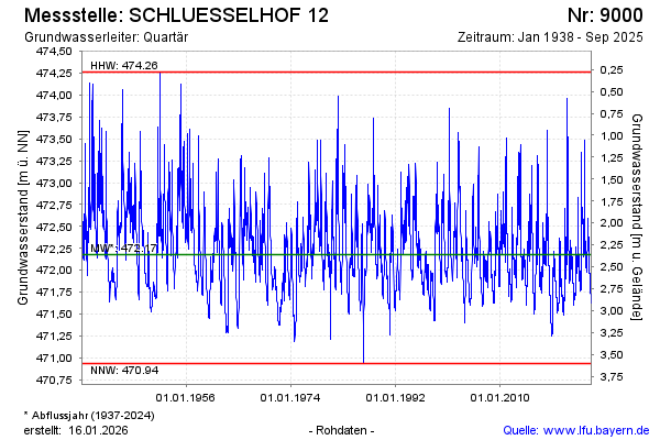
Groundwater level [m above sealevel]: 472.58
Distance to surface [m]: 1.96
Last value from 09.03.2026 13:24
Ground level [m above sealevel]: 474.54
| Date | Groundwater level [m above sealevel] |
|---|---|
| 09.03.2026 | 472.59 |
| 08.03.2026 | 472.60 |
| 07.03.2026 | 472.62 |
| 06.03.2026 | 472.64 |
| 05.03.2026 | 472.67 |
| 04.03.2026 | 472.68 |
| 03.03.2026 | 472.71 |
| 02.03.2026 | 472.73 |
© Bayerisches Landesamt für Umwelt 2026