Year chart of precipitation SCHLARBHOFEN 16
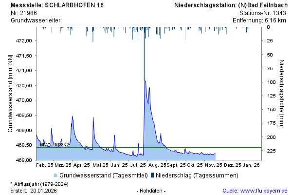
Groundwater level [m above sealevel]: 468,04
Distance to surface [m]: 3,05
Last value from 21.07.2026 14:12
Ground level [m above sealevel]: 471.09

Groundwater level [m above sealevel]: 468,04
Distance to surface [m]: 3,05
Last value from 21.07.2026 14:12
Ground level [m above sealevel]: 471.09