
- Start >
- Groundwater >
- Waterlevel of upper layer >
- Bayern >
- SAUGENDORF BT-W2 >
- Chart of total period

Chart of total period SAUGENDORF BT-W2
Groundwater levels of the total period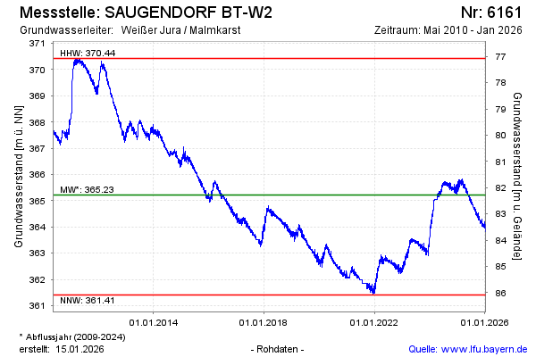
Groundwater level [m above sealevel]: 364.39
Distance to surface [m]: 83.11
Last value from 14.04.2026 10:00
Ground level [m above sealevel]: 447.50
| Date | Groundwater level [m above sealevel] |
|---|---|
| 14.04.2026 | 364.43 |
| 13.04.2026 | 364.48 |
| 12.04.2026 | 364.47 |
| 11.04.2026 | 364.47 |
| 10.04.2026 | 364.49 |
| 09.04.2026 | 364.46 |
| 08.04.2026 | 364.41 |
| 07.04.2026 | 364.41 |
© Bayerisches Landesamt für Umwelt 2026