
- Start >
- Groundwater >
- Waterlevel of upper layer >
- Bayern >
- Rudelzhausen Q 1 >
- Current data

Current data Rudelzhausen Q 1
Groundwater levels of the last 12 months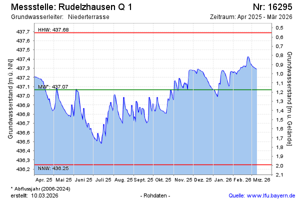
Groundwater level [m above sealevel]: 436.71
Distance to surface [m]: 1.53
Last value from 29.05.2026 10:00
Ground level [m above sealevel]: 438.24
| Date | Groundwater level [m above sealevel] |
|---|---|
| 29.05.2026 | 436.71 |
| 28.05.2026 | 436.72 |
| 27.05.2026 | 436.74 |
| 26.05.2026 | 436.76 |
| 25.05.2026 | 436.78 |
| 24.05.2026 | 436.81 |
| 23.05.2026 | 436.83 |
| 22.05.2026 | 436.86 |
© Bayerisches Landesamt für Umwelt 2026