
- Start >
- Groundwater >
- Waterlevel of upper layer >
- Bayern >
- ROTHSCHWAIGE Q 12 >
- Chart of total period

Chart of total period ROTHSCHWAIGE Q 12
Groundwater levels of the total period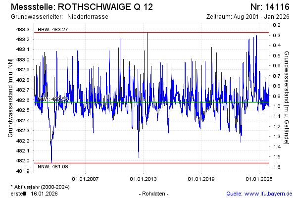
Groundwater level [m above sealevel]: 481.93
Distance to surface [m]: 1.58
Last value from 03.05.2024 10:00
Ground level [m above sealevel]: 483.51
| Date | Groundwater level [m above sealevel] |
|---|---|
| 02.05.2024 | 481.94 |
| 01.05.2024 | 481.97 |
| 30.04.2024 | 481.99 |
| 29.04.2024 | 481.98 |
| 28.04.2024 | 481.98 |
| 27.04.2024 | 482.00 |
| 26.04.2024 | 482.01 |
| 25.04.2024 | 482.03 |
© Bayerisches Landesamt für Umwelt 2024