
- Start >
- Groundwater >
- Waterlevel of upper layer >
- Bayern >
- Rothenburg >
- Current data

Current data Rothenburg
Groundwater levels of the last 12 months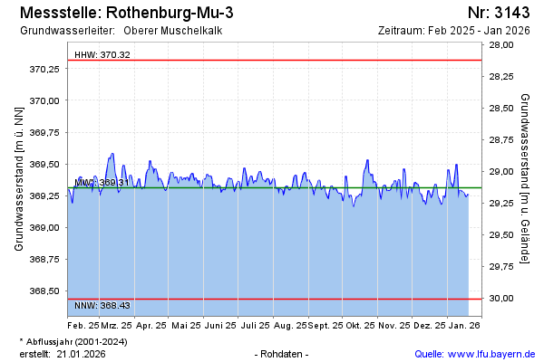
Groundwater level [m above sealevel]: 369.45
Distance to surface [m]: 28.99
Last value from 01.05.2024 13:00
Ground level [m above sealevel]: 398.44
| Date | Groundwater level [m above sealevel] |
|---|---|
| 01.05.2024 | 369.44 |
| 30.04.2024 | 369.37 |
| 29.04.2024 | 369.32 |
| 28.04.2024 | 369.40 |
| 27.04.2024 | 369.44 |
| 26.04.2024 | 369.48 |
| 25.04.2024 | 369.47 |
| 24.04.2024 | 369.46 |
© Bayerisches Landesamt für Umwelt 2024