
- Start >
- Groundwater >
- Waterlevel of upper layer >
- Bayern >
- ROSSHAUPTEN D 49 >
- Chart of total period

Chart of total period ROSSHAUPTEN D 49
Groundwater levels of the total period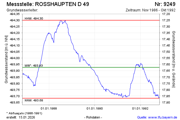
Groundwater level [m above sealevel]: 493.68
Distance to surface [m]: 17.87
Last value from 31.10.1992 23:59
Ground level [m above sealevel]: 511.55
| Date | Groundwater level [m above sealevel] |
|---|---|
| 24.10.1992 | 493.69 |
| 20.10.1992 | 493.68 |
| 11.10.1992 | 493.70 |
| 05.10.1992 | 493.71 |
| 27.09.1992 | 493.70 |
| 22.09.1992 | 493.71 |
| 13.09.1992 | 493.70 |
| 05.09.1992 | 493.71 |
© Bayerisches Landesamt für Umwelt 2026