
- Start >
- Groundwater >
- Waterlevel of upper layer >
- Bayern >
- ROHRBACH HWF P20 >
- Current data

Current data ROHRBACH HWF P20
Groundwater levels of the last 12 months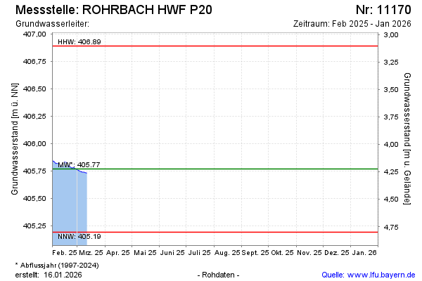
Groundwater level [m above sealevel]: 405.49
Distance to surface [m]: 4.50
Last value from 06.08.2025 13:00
Ground level [m above sealevel]: 409.99
| Date | Groundwater level [m above sealevel] |
|---|---|
| 06.08.2025 | 405.49 |
| 05.08.2025 | 405.49 |
| 04.08.2025 | 405.49 |
| 03.08.2025 | 405.48 |
| 02.08.2025 | 405.45 |
| 01.08.2025 | 405.44 |
| 31.07.2025 | 405.44 |
| 30.07.2025 | 405.44 |
© Bayerisches Landesamt für Umwelt 2026