
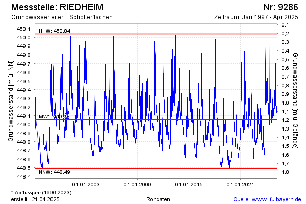
Chart of total period RIEDHEIM
Groundwater level [m above sealevel]: 448.55
Distance to surface [m]: 1.7
Last value from 14.07.2026 11:00
Ground level [m above sealevel]: 450.25
| Date | Groundwater level [m above sealevel] |
|---|---|
| 14.07.2026 | 448.55 |
| 13.07.2026 | 448.55 |
| 12.07.2026 | 448.56 |
| 11.07.2026 | 448.57 |
| 10.07.2026 | 448.58 |
| 09.07.2026 | 448.58 |
| 08.07.2026 | 448.59 |
| 07.07.2026 | 448.59 |