
Chart of total period RIED R 37
note
Messstelle wird nicht mehr beobachtet.
Groundwater level [m above sealevel]: 496,19
Distance to surface [m]: 5,66
Last value from 13.05.2025 10:00
Ground level [m above sealevel]: 501.85
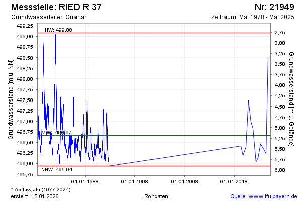
| Date | Groundwater level [m above sealevel] |
|---|---|
| 10.10.2024 | 498.48 |
| 13.05.2024 | 496.24 |
| 11.10.2023 | 496.37 |
| 02.05.2023 | 496.46 |
| 10.10.2022 | 496.13 |
| 04.05.2022 | 496.04 |
| 07.10.2021 | 496.83 |
| 11.05.2021 | 496.99 |