
- Start >
- Groundwater >
- Waterlevel of upper layer >
- Bayern >
- REHLING 739 >
- Current data

Current data REHLING 739
Groundwater levels of the last 12 months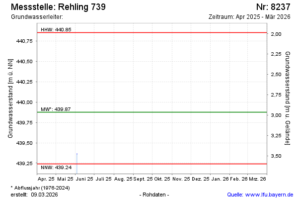
Groundwater level [m above sealevel]: 439.47
Distance to surface [m]: 3.37
Last value from 16.12.2025 10:00
Ground level [m above sealevel]: 442.84
| Date | Groundwater level [m above sealevel] |
|---|---|
| 04.06.2025 | 439.36 |
| 03.06.2025 | 439.36 |
| 05.12.2024 | 439.62 |
| 05.07.2024 | 440.31 |
| 15.12.2023 | 440.52 |
| 14.06.2023 | 439.62 |
| 30.11.2022 | 439.31 |
| 20.06.2022 | 439.38 |
© Bayerisches Landesamt für Umwelt 2026