
- Start >
- Groundwater >
- Waterlevel of upper layer >
- Bayern >
- Recheldorf KMS 1 >
- Current data

Current data Recheldorf KMS 1
Groundwater levels of the last 12 months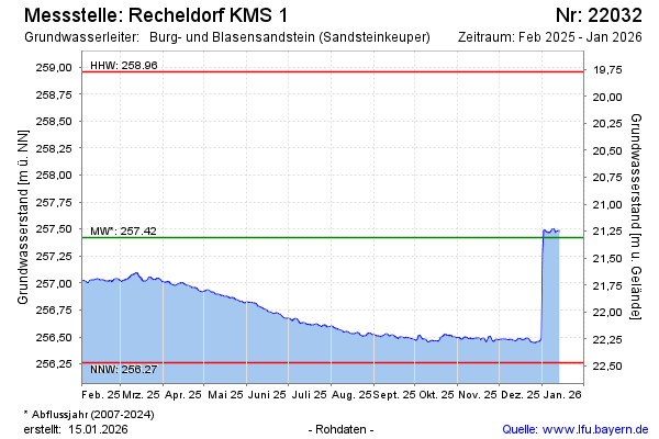
Groundwater level [m above sealevel]: 257.57
Distance to surface [m]: 21.16
Last value from 05.03.2026 10:00
Ground level [m above sealevel]: 278.73
| Date | Groundwater level [m above sealevel] |
|---|---|
| 06.03.2026 | 257.59 |
| 05.03.2026 | 257.58 |
| 04.03.2026 | 257.57 |
| 03.03.2026 | 257.57 |
| 02.03.2026 | 257.57 |
| 01.03.2026 | 257.57 |
| 28.02.2026 | 257.58 |
| 27.02.2026 | 257.57 |
© Bayerisches Landesamt für Umwelt 2026