
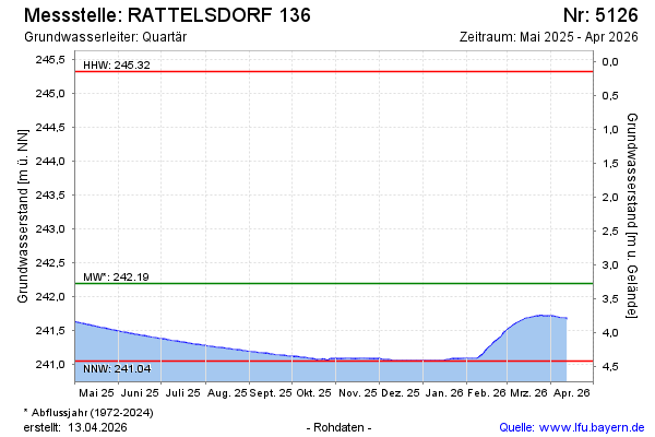
Current data RATTELSDORF 136
Groundwater level [m above sealevel]: 241,31
Distance to surface [m]: 4,16
Last value from 22.07.2026 08:00
Ground level [m above sealevel]: 245.47
| Date | Groundwater level [m above sealevel] |
|---|---|
| 22.07.2026 | 241.31 |
| 21.07.2026 | 241.31 |
| 20.07.2026 | 241.31 |
| 19.07.2026 | 241.32 |
| 18.07.2026 | 241.32 |
| 17.07.2026 | 241.32 |
| 16.07.2026 | 241.32 |
| 15.07.2026 | 241.33 |