
- Start >
- Groundwater >
- Waterlevel of upper layer >
- Bayern >
- RAIN/LECH 108A >
- Chart of total period

Chart of total period RAIN/LECH 108A
Groundwater levels of the total period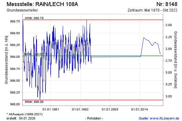
Groundwater level [m above sealevel]: 399.44
Distance to surface [m]: 2.23
Last value from 11.10.2022 10:00
Ground level [m above sealevel]: 401.67
| Date | Groundwater level [m above sealevel] |
|---|---|
| 05.10.2021 | 399.06 |
| 13.10.2020 | 399.27 |
| 26.09.2019 | 399.31 |
| 19.09.2018 | 399.23 |
| 22.05.2017 | 399.34 |
| 21.09.2016 | 399.35 |
| 18.06.2015 | 399.40 |
| 12.11.2014 | 399.15 |
© Bayerisches Landesamt für Umwelt 2026