
Chart of total period RAIN II_2
Groundwater level [m above sealevel]: 401,09
Distance to surface [m]: 2,08
Last value from 28.11.2014 10:00
Ground level [m above sealevel]: 403.17
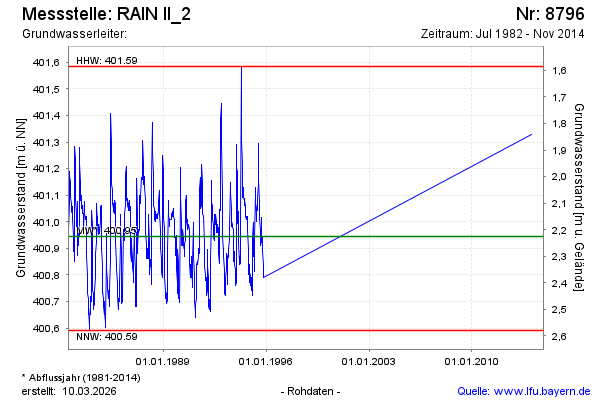
| Date | Groundwater level [m above sealevel] |
|---|---|
| 28.01.2014 | 401.33 |
| 30.10.1995 | 400.79 |
| 23.10.1995 | 400.81 |
| 17.10.1995 | 400.84 |
| 09.10.1995 | 400.89 |
| 02.10.1995 | 400.93 |
| 25.09.1995 | 400.94 |
| 19.09.1995 | 400.94 |