
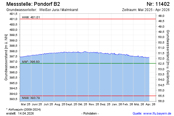
Current data Pondorf B2
Groundwater level [m above sealevel]: 396.97
Distance to surface [m]: 52.34
Last value from 15.07.2026 05:00
Ground level [m above sealevel]: 449.31
| Date | Groundwater level [m above sealevel] |
|---|---|
| 14.07.2026 | 396.98 |
| 13.07.2026 | 396.98 |
| 12.07.2026 | 396.97 |
| 11.07.2026 | 396.99 |
| 10.07.2026 | 397.00 |
| 09.07.2026 | 397.00 |
| 08.07.2026 | 397.01 |
| 07.07.2026 | 397.03 |