
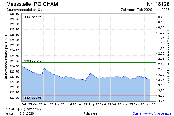
Current data POIGHAM
note
GW Messstelle im Grundnetz
Groundwater level [m above sealevel]: 323.13
Distance to surface [m]: 3.47
Last value from 24.06.2026 03:50
Ground level [m above sealevel]: 326.60
| Date | Groundwater level [m above sealevel] |
|---|---|
| 28.06.2026 | 323.11 |
| 27.06.2026 | 323.11 |
| 26.06.2026 | 323.12 |
| 25.06.2026 | 323.12 |
| 24.06.2026 | 323.13 |
| 23.06.2026 | 323.13 |
| 22.06.2026 | 323.14 |
| 21.06.2026 | 323.14 |