
- Start >
- Groundwater >
- Waterlevel of upper layer >
- Bayern >
- Pörndorf ost >
- Current data

Current data Pörndorf ost
Groundwater levels of the last 12 months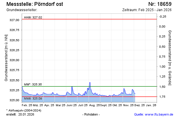
note
GW Messstelle im SN Flussraum Vils
Groundwater level [m above sealevel]: 325.11
Distance to surface [m]: 1.73
Last value from 25.04.2026 11:20
Ground level [m above sealevel]: 326.84
| Date | Groundwater level [m above sealevel] |
|---|---|
| 15.04.2026 | 325.11 |
| 14.04.2026 | 325.12 |
| 13.04.2026 | 325.12 |
| 12.04.2026 | 325.13 |
| 11.04.2026 | 325.14 |
| 10.04.2026 | 325.12 |
| 09.04.2026 | 325.12 |
| 08.04.2026 | 325.12 |
© Bayerisches Landesamt für Umwelt 2026