
Chart of total period POCKINGER HEIDE
note
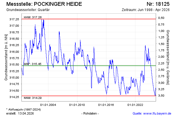
GW Messstelle im Grundnetz
Groundwater level [m above sealevel]: 314,22
Distance to surface [m]: 3,58
Last value from 22.07.2026 21:29
Ground level [m above sealevel]: 317.80
| Date | Groundwater level [m above sealevel] |
|---|---|
| 22.07.2026 | 314.22 |
| 21.07.2026 | 314.22 |
| 20.07.2026 | 314.23 |
| 19.07.2026 | 314.23 |
| 18.07.2026 | 314.23 |
| 17.07.2026 | 314.24 |
| 16.07.2026 | 314.24 |
| 15.07.2026 | 314.24 |