
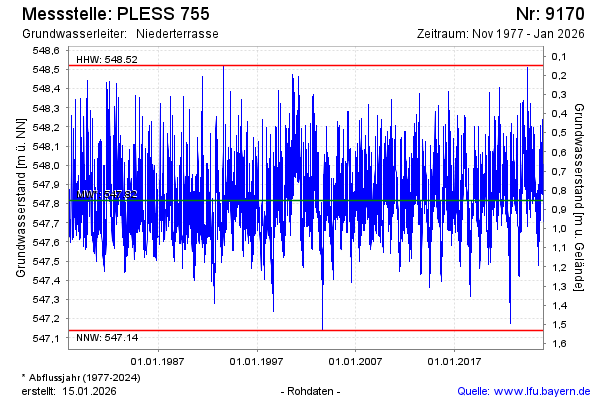
Chart of total period PLESS 755
Groundwater level [m above sealevel]: 547.02
Distance to surface [m]: 1.65
Last value from 15.07.2026 04:00
Ground level [m above sealevel]: 548.67
| Date | Groundwater level [m above sealevel] |
|---|---|
| 14.07.2026 | 546.95 |
| 13.07.2026 | 546.96 |
| 12.07.2026 | 546.98 |
| 11.07.2026 | 547.00 |
| 10.07.2026 | 547.02 |
| 09.07.2026 | 547.04 |
| 08.07.2026 | 547.06 |
| 07.07.2026 | 547.08 |