
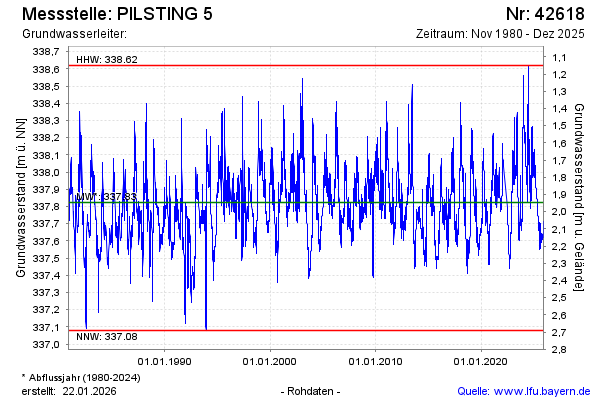
Chart of total period PILSTING 5
Groundwater level [m above sealevel]: 337,71
Distance to surface [m]: 2,06
Last value from 13.05.2026 10:25
Ground level [m above sealevel]: 339.77
| Date | Groundwater level [m above sealevel] |
|---|---|
| 13.05.2026 | 337.71 |
| 12.05.2026 | 337.72 |
| 11.05.2026 | 337.71 |
| 10.05.2026 | 337.71 |
| 09.05.2026 | 337.72 |
| 08.05.2026 | 337.72 |
| 07.05.2026 | 337.73 |
| 06.05.2026 | 337.73 |