
- Start >
- Groundwater >
- Waterlevel of upper layer >
- Bayern >
- PETTENHOFEN 121 >
- Chart of total period

Chart of total period PETTENHOFEN 121
Groundwater levels of the total period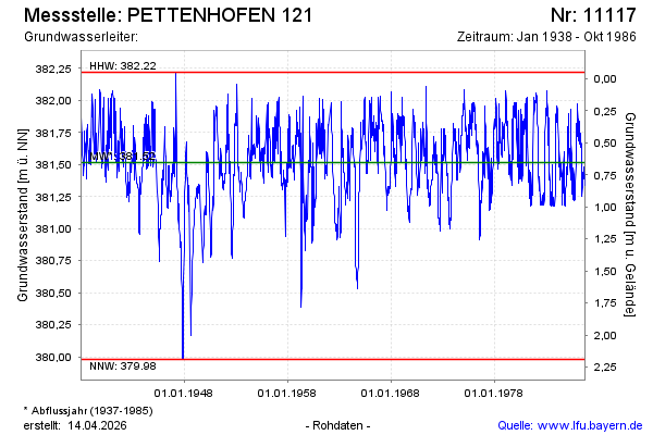
Groundwater level [m above sealevel]: 381.66
Distance to surface [m]: 0.51
Last value from 27.10.1986 12:00
Ground level [m above sealevel]: 382.17
| Date | Groundwater level [m above sealevel] |
|---|---|
| 20.10.1986 | 381.39 |
| 13.10.1986 | 381.34 |
| 06.10.1986 | 381.35 |
| 29.09.1986 | 381.41 |
| 22.09.1986 | 381.45 |
| 15.09.1986 | 381.48 |
| 08.09.1986 | 381.43 |
| 01.09.1986 | 381.39 |
© Bayerisches Landesamt für Umwelt 2026