
Current data PARSDORF 454A
note
Beobachtung halbjährlich.
Groundwater level [m above sealevel]: 514.90
Distance to surface [m]: 9.6900000000001
Last value from 15.04.2026 13:14
Ground level [m above sealevel]: 524.59
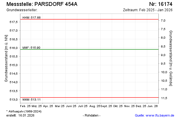
| Date | Groundwater level [m above sealevel] |
|---|---|
| 14.10.2025 | 515.45 |
| 23.04.2025 | 515.81 |
| 09.10.2024 | 516.16 |
| 24.06.2024 | 515.41 |
| 17.04.2024 | 514.80 |
| 18.10.2023 | 514.04 |
| 01.09.2023 | -- |
| 31.08.2023 | -- |