
- Start >
- Groundwater >
- Waterlevel of upper layer >
- Bayern >
- PANG 354 >
- Chart of total period

Chart of total period PANG 354
Groundwater levels of the total period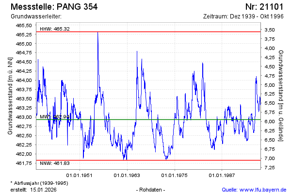
note
Die Messstelle wurde 1996 zurück gebaut.
Groundwater level [m above sealevel]: 463.34
Distance to surface [m]: 5.54
Last value from 28.10.1996 12:00
Ground level [m above sealevel]: 468.88
| Date | Groundwater level [m above sealevel] |
|---|---|
| 21.10.1996 | 463.35 |
| 14.10.1996 | 463.35 |
| 07.10.1996 | 463.36 |
| 30.09.1996 | 463.34 |
| 23.09.1996 | 463.33 |
| 16.09.1996 | 463.35 |
| 09.09.1996 | 463.36 |
| 02.09.1996 | 463.39 |
© Bayerisches Landesamt für Umwelt 2026