
- Start >
- Groundwater >
- Waterlevel of upper layer >
- Bayern >
- Ottering T7 >
- Current data

Current data Ottering T7
Groundwater levels of the last 12 months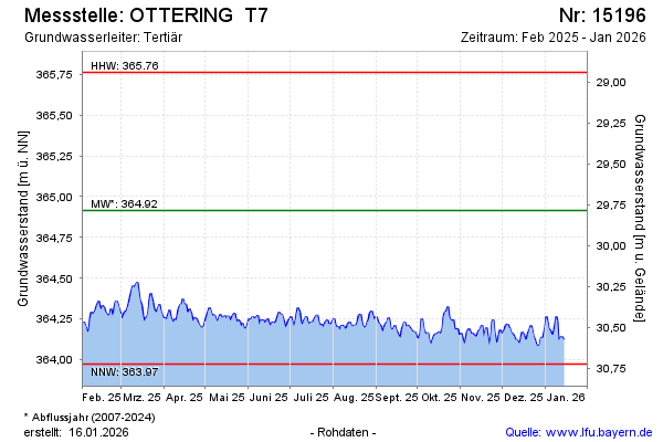
Groundwater level [m above sealevel]: 364.31
Distance to surface [m]: 30.39
Last value from 16.05.2024 10:00
Ground level [m above sealevel]: 394.70
| Date | Groundwater level [m above sealevel] |
|---|---|
| 15.05.2024 | 364.31 |
| 14.05.2024 | 364.29 |
| 13.05.2024 | 364.26 |
| 12.05.2024 | 364.23 |
| 11.05.2024 | 364.20 |
| 10.05.2024 | 364.19 |
| 09.05.2024 | 364.17 |
| 08.05.2024 | 364.20 |
© Bayerisches Landesamt für Umwelt 2024