
- Start >
- Groundwater >
- Waterlevel of upper layer >
- Bayern >
- Obersinn >
- Current data

Current data Obersinn
Groundwater levels of the last 12 months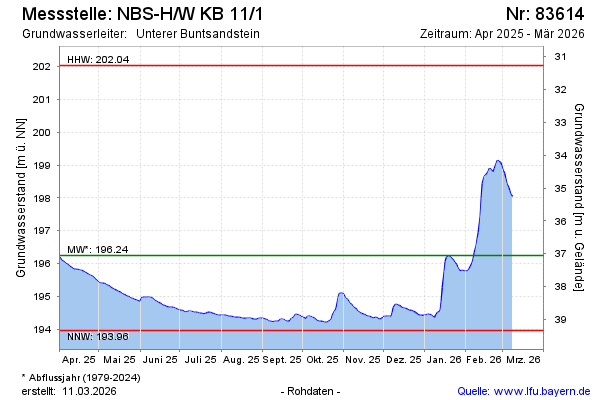
Groundwater level [m above sealevel]: 195.67
Distance to surface [m]: 37.63
Last value from 15.04.2026 10:00
Ground level [m above sealevel]: 233.30
| Date | Groundwater level [m above sealevel] |
|---|---|
| 15.04.2026 | 195.68 |
| 14.04.2026 | 195.70 |
| 13.04.2026 | 195.73 |
| 12.04.2026 | 195.75 |
| 11.04.2026 | 195.77 |
| 10.04.2026 | 195.80 |
| 09.04.2026 | 195.84 |
| 08.04.2026 | 195.88 |
© Bayerisches Landesamt für Umwelt 2026