
- Start >
- Groundwater >
- Waterlevel of upper layer >
- Bayern >
- OBERADLFURT R 42 >
- Current data

Current data OBERADLFURT R 42
Groundwater levels of the last 12 months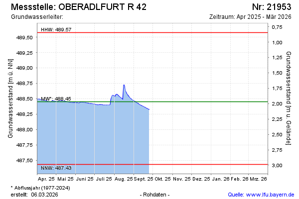
Groundwater level [m above sealevel]: 488.32
Distance to surface [m]: 2.10
Last value from 25.09.2025 09:00
Ground level [m above sealevel]: 490.42
| Date | Groundwater level [m above sealevel] |
|---|---|
| 25.09.2025 | 488.32 |
| 24.09.2025 | 488.33 |
| 23.09.2025 | 488.33 |
| 22.09.2025 | 488.34 |
| 21.09.2025 | 488.34 |
| 20.09.2025 | 488.35 |
| 19.09.2025 | 488.35 |
| 18.09.2025 | 488.36 |
© Bayerisches Landesamt für Umwelt 2026