
- Start >
- Groundwater >
- Waterlevel of upper layer >
- Bayern >
- NORDW. ILLERTISSEN L >
- Chart of total period

Chart of total period NORDW. ILLERTISSEN L
Groundwater levels of the total period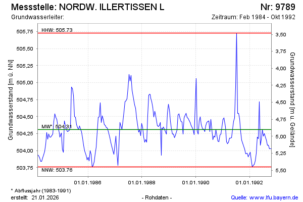
Groundwater level [m above sealevel]: 504.03
Distance to surface [m]: 5.18
Last value from 26.10.1992 12:00
Ground level [m above sealevel]: 509.21
| Date | Groundwater level [m above sealevel] |
|---|---|
| 13.10.1992 | 504.03 |
| 29.09.1992 | 504.03 |
| 14.09.1992 | 504.08 |
| 31.08.1992 | 504.08 |
| 18.08.1992 | 504.15 |
| 04.08.1992 | 504.20 |
| 21.07.1992 | 504.25 |
| 08.07.1992 | 504.21 |
© Bayerisches Landesamt für Umwelt 2025