
Chart of total period NOERDLINGEN 11
Groundwater level [m above sealevel]: 418,11
Distance to surface [m]: 0,99
Last value from 17.07.1967 12:00
Ground level [m above sealevel]: 419.10
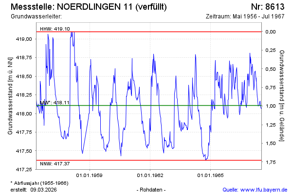
| Date | Groundwater level [m above sealevel] |
|---|---|
| 10.07.1967 | 418.07 |
| 03.07.1967 | 418.07 |
| 26.06.1967 | 418.09 |
| 19.06.1967 | 418.17 |
| 12.06.1967 | 418.15 |
| 05.06.1967 | 418.13 |
| 29.05.1967 | 418.11 |
| 22.05.1967 | 418.11 |