
- Start >
- Groundwater >
- Waterlevel of upper layer >
- Bayern >
- NIEDERSCHOENENFELD109A >
- Chart of total period

Chart of total period NIEDERSCHOENENFELD109A
Groundwater levels of the total period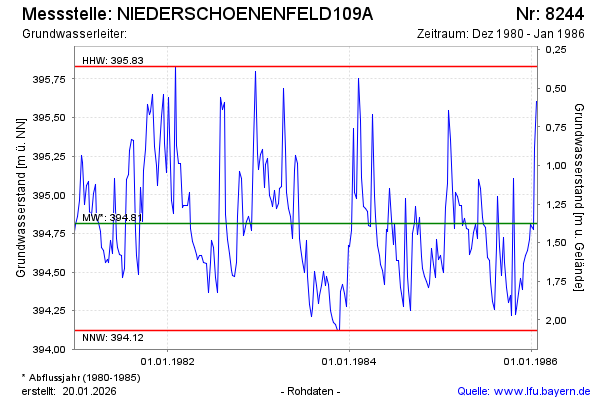
Groundwater level [m above sealevel]: 395.51
Distance to surface [m]: 0.68
Last value from 27.01.1986 12:00
Ground level [m above sealevel]: 396.19
| Date | Groundwater level [m above sealevel] |
|---|---|
| 20.01.1986 | 395.60 |
| 13.01.1986 | 395.30 |
| 08.01.1986 | 394.77 |
| 30.12.1985 | 394.81 |
| 23.12.1985 | 394.71 |
| 16.12.1985 | 394.64 |
| 09.12.1985 | 394.61 |
| 02.12.1985 | 394.56 |
© Bayerisches Landesamt für Umwelt 2025