
- Start >
- Groundwater >
- Waterlevel of upper layer >
- Bayern >
- NIEDERPOERING B 98 >
- Chart of total period

Chart of total period NIEDERPOERING B 98
Groundwater levels of the total period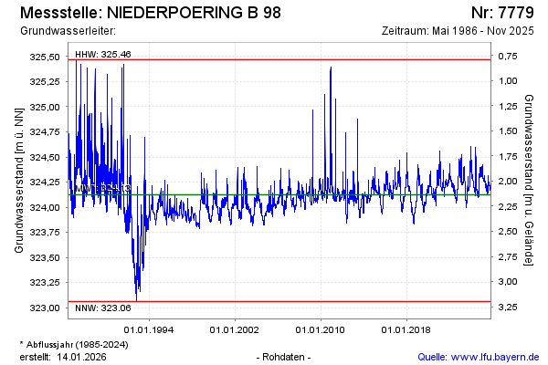
Groundwater level [m above sealevel]: 324.23
Distance to surface [m]: 2.03
Last value from 20.01.2026 14:55
Ground level [m above sealevel]: 326.26
| Date | Groundwater level [m above sealevel] |
|---|---|
| 20.01.2026 | 324.23 |
| 19.01.2026 | 324.23 |
| 18.01.2026 | 324.23 |
| 17.01.2026 | 324.23 |
| 16.01.2026 | 324.23 |
| 15.01.2026 | 324.23 |
| 14.01.2026 | 324.22 |
| 13.01.2026 | 324.22 |
© Bayerisches Landesamt für Umwelt 2026