
- Start >
- Groundwater >
- Waterlevel of upper layer >
- Bayern >
- NIEDERLEIERNDF.LA. S5 >
- Chart of total period

Chart of total period NIEDERLEIERNDF.LA. S5
Groundwater levels of the total period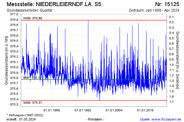
Groundwater level [m above sealevel]: 375.78
Distance to surface [m]: 1.27
Last value from 23.01.2026 10:00
Ground level [m above sealevel]: 377.05
| Date | Groundwater level [m above sealevel] |
|---|---|
| 23.01.2026 | 375.78 |
| 22.01.2026 | 375.79 |
| 21.01.2026 | 375.81 |
| 20.01.2026 | 375.82 |
| 19.01.2026 | 375.84 |
| 18.01.2026 | 375.85 |
| 17.01.2026 | 375.86 |
| 16.01.2026 | 375.90 |
© Bayerisches Landesamt für Umwelt 2026