
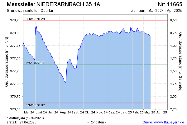
Current data NIEDERARNBACH 35.1A
Groundwater level [m above sealevel]: 377.88
Distance to surface [m]: 0.87
Last value from 01.04.2026 14:00
Ground level [m above sealevel]: 378.75
| Date | Groundwater level [m above sealevel] |
|---|---|
| 01.04.2026 | 377.88 |
| 31.03.2026 | 377.88 |
| 30.03.2026 | 377.89 |
| 29.03.2026 | 377.88 |
| 28.03.2026 | 377.88 |
| 27.03.2026 | 377.90 |
| 26.03.2026 | 377.91 |
| 25.03.2026 | 377.91 |