
- Start >
- Groundwater >
- Waterlevel of upper layer >
- Bayern >
- Niederalteich (Q7) >
- Current data

Current data Niederalteich (Q7)
Groundwater levels of the last 12 months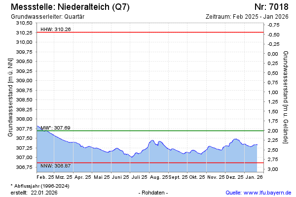
note
Derzeit Umbau der Datenfernübertragung
Groundwater level [m above sealevel]: 307.45
Distance to surface [m]: 2.25
Last value from 03.05.2026 08:00
Ground level [m above sealevel]: 309.70
| Date | Groundwater level [m above sealevel] |
|---|---|
| 03.05.2026 | 307.43 |
| 02.05.2026 | 307.46 |
| 01.05.2026 | 307.44 |
| 30.04.2026 | 307.48 |
| 29.04.2026 | 307.53 |
| 28.04.2026 | 307.51 |
| 27.04.2026 | 307.50 |
| 26.04.2026 | 307.55 |
© Bayerisches Landesamt für Umwelt 2026