
- Start >
- Groundwater >
- Waterlevel of upper layer >
- Bayern >
- N15 - HWS Mörnbach >
- Chart of total period

Chart of total period N15 - HWS Mörnbach
Groundwater levels of the total period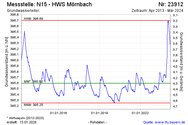
Groundwater level [m above sealevel]: 396.21
Distance to surface [m]: 3.68
Last value from 11.03.2024 11:00
Ground level [m above sealevel]: 399.89
| Date | Groundwater level [m above sealevel] |
|---|---|
| 11.03.2024 | 396.21 |
| 10.03.2024 | 396.22 |
| 09.03.2024 | 396.23 |
| 08.03.2024 | 396.23 |
| 07.03.2024 | 396.24 |
| 06.03.2024 | 396.25 |
| 05.03.2024 | 396.26 |
| 04.03.2024 | 396.27 |
© Bayerisches Landesamt für Umwelt 2026